DMV Hikes: North Fork Mountain to Chimney Top

Do you live in Washington DC? Are you looking for a challenging day hike within reach of the city? Then you should check out North Fork Mountain. It’s less than 3 hrs away which means you can start and end the day at home in your own bed. But I’ll also cover camping and cabin options for people who don’t like long road trips.
North Fork Mountain is a 34-mile long ridgeline that contains the highest point in West Virginia. It’s located in the Monongahela National Forest.
There are several routes you can try in All Trails.
I recommend North Fork Mountain to Chimney Top in Cabins, WV. It’s a 5.2 mile hike with 2,000 ft of elevation gain. To get started, drive to the small parking lot off Smoke Hole Rd. If you’re coming from DC, don’t forget to make a last minute pit stop in Petersburg, WV. I suggest the Sheetz gas station. The bathroom is clean, they have ice and you can grab supplies like water or electrolyte drinks.
Now that you’re fueled up and ready to go, drive six miles west on WV-28, turn left onto Smoke Hole Rd and cross a bridge over the North Fork South Branch Potomac River. If you’re lucky, you’ll find a spot at the Chimney Top trailhead. There’s room for maybe ten cars. If you get a spot, head uphill! The trail is easy to follow and well-blazed with blue diamond markers. If you’re worried about getting turned around, I recommend using AllTrails and downloading the trail map ahead of time.
There are a few mini switchbacks but it’s largely an uphill climb until you get to the ridgeline. In the summer, enjoy the thickets of mountain laurel – the bell shaped, white flowers that line both sides of the trail. The blooms are super distracting in the best way! Or hike later in the year to appreciate Fall colors along with the spectacular views.


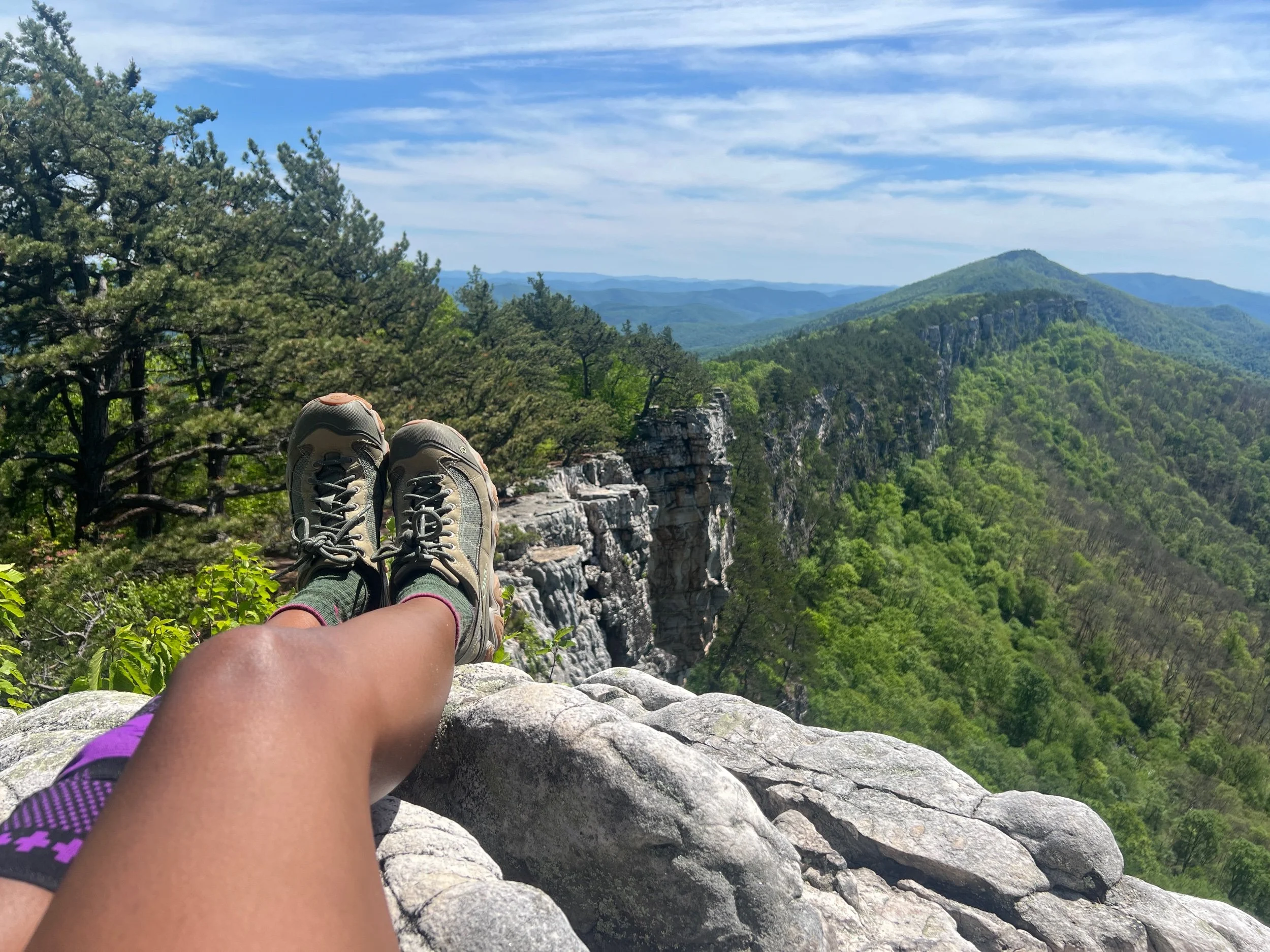
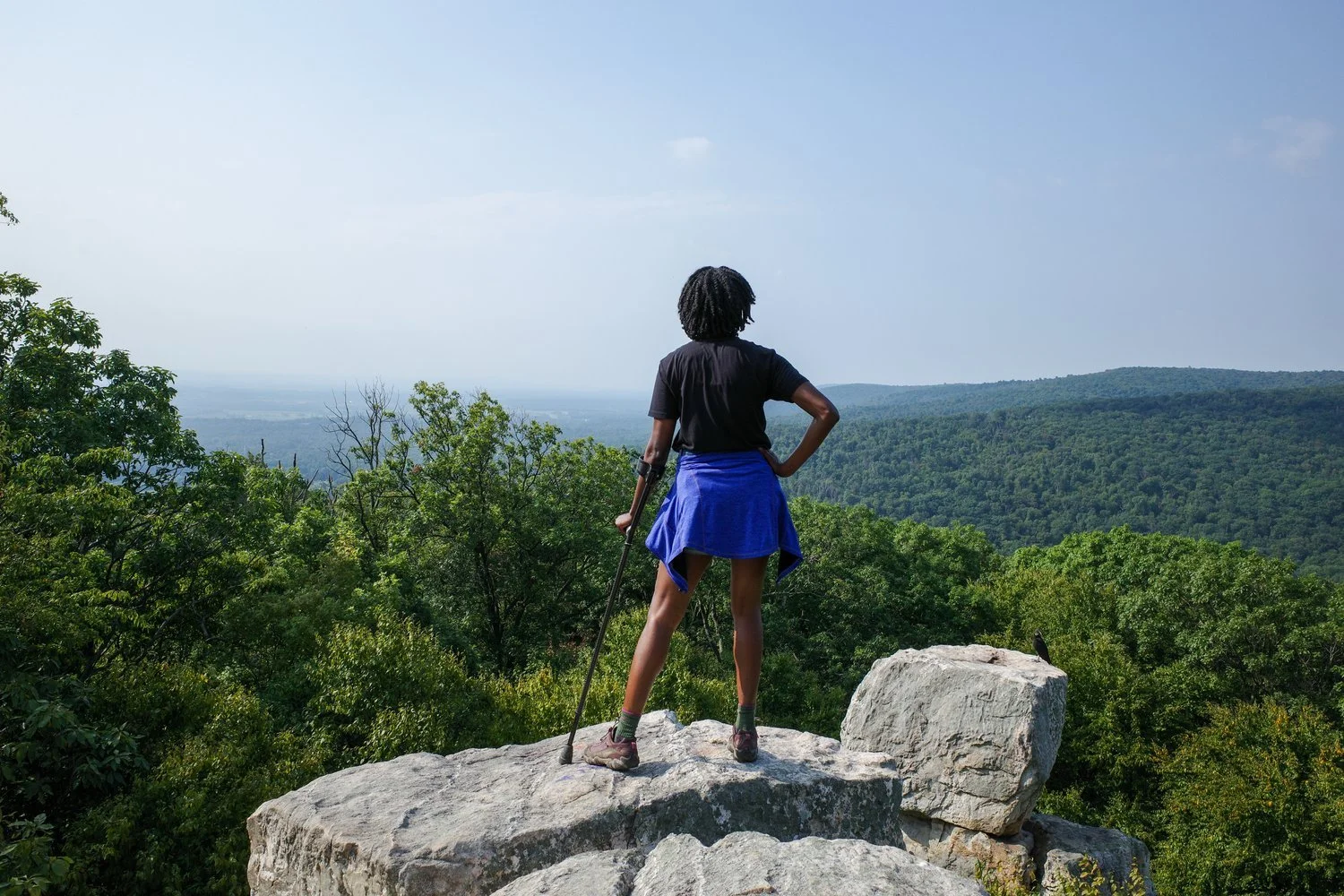
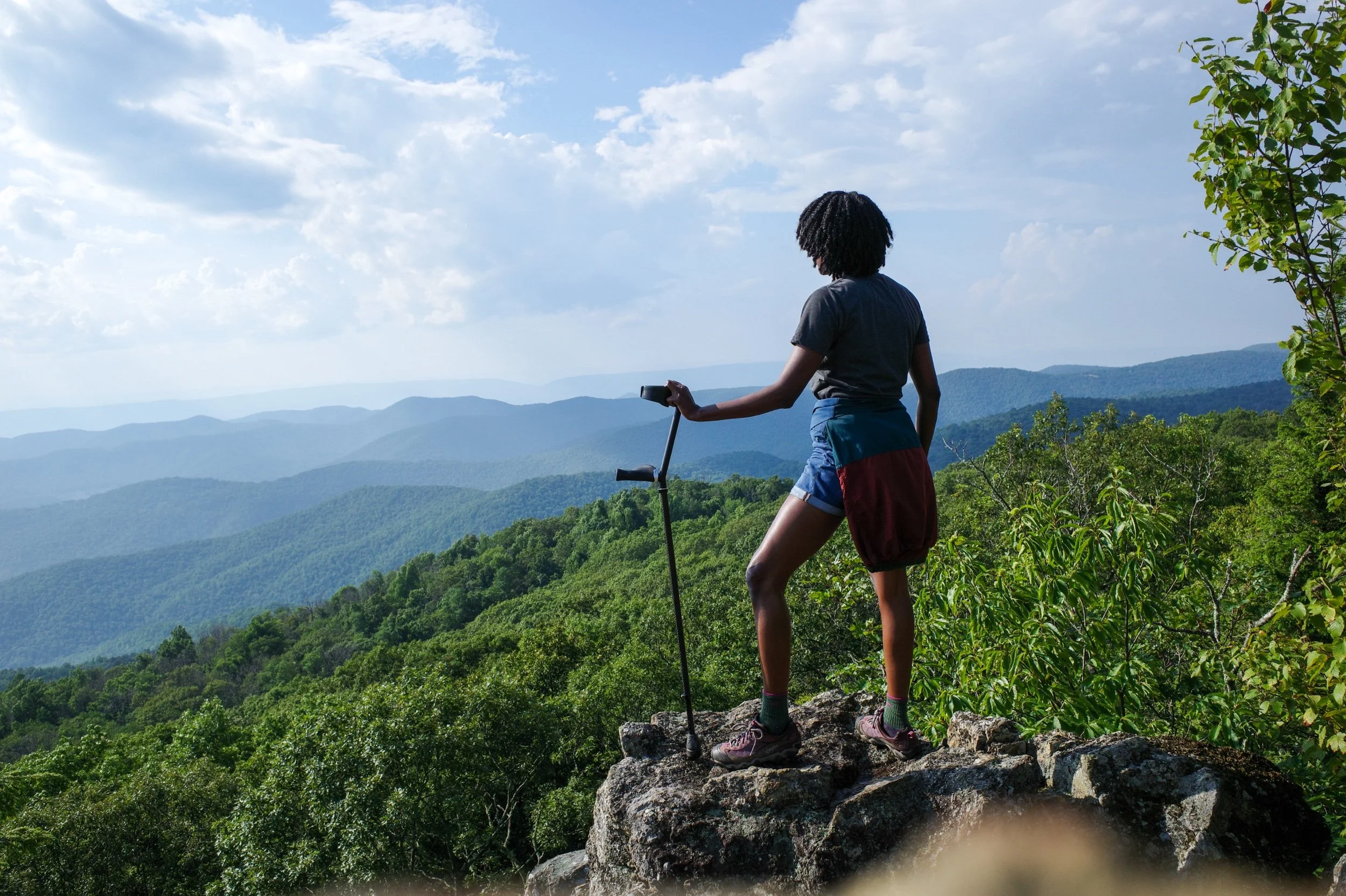
Once you reach the ridgeline, you’re rewarded with beautiful semi-secluded overlooks every few feet. Even if the trail is crowded, you’ll have plenty of space to stretch out, feel the wind on your face and pretend to be alone, if that’s your thing. And the best is still ahead!
To reach Chimney Top, keep following the trail. Eventually it connects to a spur trail that may or may not be marked by a small cairn. That leads you to a handful of large sandstone rock formations: your final boss–I mean overlook! Chimney Top is impressive but after taking a few photos your eye will be drawn to a beautiful curve of ridgeline stretching out for 34 miles in the distance.
Intrigued? The North Fork Mountain Trail is a 22-mile out and back hike. Or you could make it a 23-mile point-to-point hike from Rt 28 to Rt 33. Those are much more challenging excursions that I would recommend doing with friends!
Wildlife
There are plenty of warnings about bears on the official signage. I solo hike on North Fork Mountain and always carry bear spray with me. However, the reality is that bear hunting is extremely popular in Monongahela National Forest, and black bears are scared of people and dogs. You are much more likely to spot deer, snakes, squirrels and other wildlife. Still, if you do encounter a black bear, follow this advice from the Forest Service. If you’re slightly stressed out, so am I. As a solo hiker, I’m not sure how I’m supposed to get big, make noise, back away slowly, and use my bear spray all at the same time. Maybe I should practice.
Water
You must bring your own water. There are no creeks, streams or water sources along the ridgeline. I usually bring a 3L CamelBak, or 2L of water in smaller canteens plus a gatorade. This hike feels pretty strenuous and you will definitely sweat a lot. I get that some hikes can be done in flip flops with a coffee in hand and no water. This isn’t one of them. So make sure you bring enough water and stay hydrated throughout your hike!
Local area
From my point of view, people are friendly enough and used to seeing out-of-town license plates and hikers. During leaf peeping season this trail gets pretty busy on the weekends. During the rest of the year – and especially on weekdays – it’s not as popular. I’ve had one negative experience at North Fork with a hiker who followed me up the trail — not a crime — doubled back along the ridgeline and found me at a semi-secluded overlook. He showed me his holstered gun and downloaded 60 mins of MAGA/conspiracy theory brainrot while I listened politely, too afraid to interrupt or walk away. That was unnerving; but it’s not the norm. I was hiking alone on a weekday. Lesson learned. I recommend hiking North Fork on the weekend, or with friends or a leashed dog, if that is an option. Or try nearby Seneca Rocks, if you want a less isolated experience.
What to bring
Check out this list of hiking essentials from the American Hiking Society. When I hike North Fork, I generally bring food, water, a basic first aid kit, extra layers since it’s usually windy and cooler along the ridgeline, my phone with All Trails and a downloaded map, insect repellent and bear spray. I don’t wear hiking boots but I do wear hiking trainers that are super durable and water resistant. I think it would be difficult to get lost at North Fork but it’s definitely possible to sprain an ankle. Fortunately, cell phone reception is pretty good.
Camping and cabins
If you don’t feel like making the roundtrip from D.C. in one day, you have options. Smoke Hole Resort has log cabins, cottages, RV spots and a motel. Expect to pay DC prices or higher.
There’s also Big Bend campground in Smoke Hole canyon near the South Branch of the Potomac River. It’s maintained by the Forest Service. Some of the campsites are first come, first served. Others can be reserved online. So make your reservation, April through October. Max stay is 14 days. Fees are listed on the site.
Happy hiking!


We kicked off from the South Kaibab Trailhead at 4:30 AM, in the dark, our headlamps lighting the way. The morning was cool—perfect hiking weather—and the sky was just starting to hint at the sunrise. The trail drops fast, and within minutes we weaved our way down steep switchbacks, passing early-bird day hikers and the occasional runner already charging uphill.